
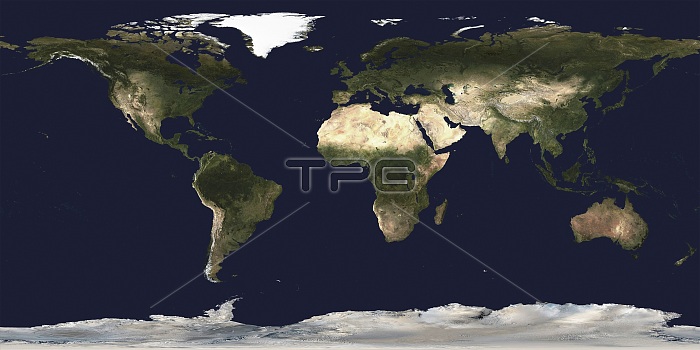
World map, satellite image. This image is based on date from NASA and NOAA satellites.
| px | px | dpi | = | cm | x | cm | = | MB |
Details
Creative#:
TOP25186173
Source:
達志影像
Authorization Type:
RM
Release Information:
須由TPG 完整授權
Model Release:
N/A
Property Release:
N/A
Right to Privacy:
No
Same folder images:
AFRICAANTARCTICARCTICASIAAUSTRALASIAAUSTRALIACLOUDFREECLOUD-FREECONTINENTALCONTINENTSCYLINDRICALPROJECTIONENVIRONMENTENVIRONMENTALEURASIAEUROPEFROMSPACEGEOGRAPHICALGLOBALICECOVERLANDCOVERNASANATIONALOCEANICANDATMOSPHERICADMINISTRATIONNOAANORTHAMERICAOCEANCOVEROCEANICPLANETARYRAPIDCHANGESEACOVERSOUTHAMERICAWATERCOVERWORLDWORLDWIDENO-ONENOBODYPLANETREGIONCONTINENTEARTHOBSERVATIONGEOGRAPHYCLIMATOLOGYEARTHSCIENCESATELLITEIMAGESATELLITE21STCENTURY
21STADMINISTRATIONAFRICAAMERICAAMERICAANDANTARCTICARCTICASIAATMOSPHERICAUSTRALASIAAUSTRALIACENTURYCHANGECLIMATOLOGYCLOUDCLOUD-FREECONTINENTCONTINENTALCONTINENTSCOVERCOVERCOVERCOVERCOVERCYLINDRICALEARTHEARTHENVIRONMENTENVIRONMENTALEURASIAEUROPEFREEFROMGEOGRAPHICALGEOGRAPHYGLOBALICEIMAGELANDNASANATIONALNO-ONENOAANOBODYNORTHOBSERVATIONOCEANOCEANICOCEANICPLANETPLANETARYPROJECTIONRAPIDREGIONSATELLITESATELLITESCIENCESEASOUTHSPACEWATERWORLDWORLDWIDE
 Loading