
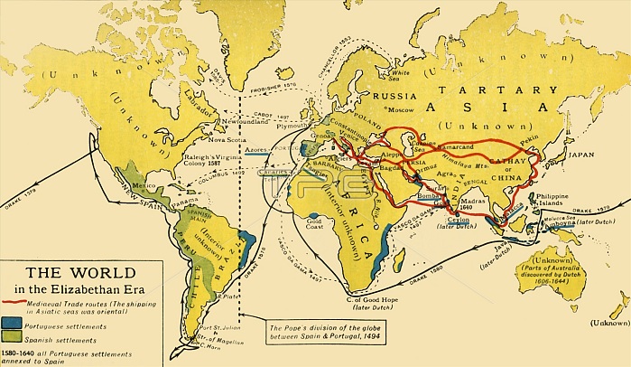
'The World in the Elizabethan Era', 1926. Map of the world during the reign of Queen Elizabeth I (1558-1603). The key shows: 'Mediaeval Trade routes, (the shipping in Asiatic seas was oriental). Portuguese and Spanish settlements'. The dotted line from Greenland down through eastern Brazil represents the Pope's division of the globe between Spain and Portugal, 1494. Also marked are the voyages of Francis Drake, Vasco da Gama and Christopher Columbus. Many parts of the world remained 'unknown' at that period. From "History of England", by George Macaulay Trevelyan. [Longmans, Green and Co. Ltd, London, 1926]
| px | px | dpi | = | cm | x | cm | = | MB |
Details
Creative#:
TOP24718487
Source:
達志影像
Authorization Type:
RM
Release Information:
須由TPG 完整授權
Model Release:
No
Property Release:
No
Right to Privacy:
No
Same folder images:
 Loading