
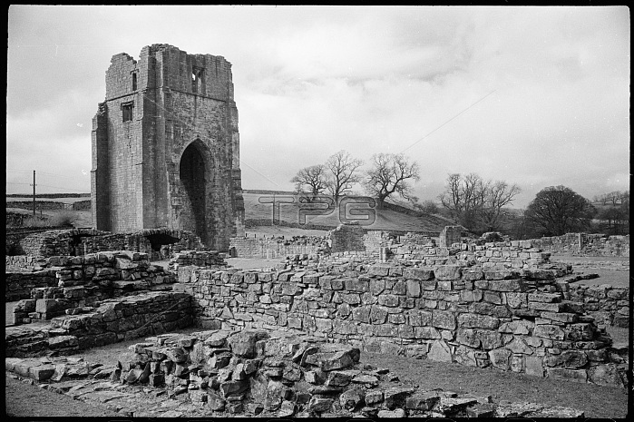
Shap Abbey, Cumbria, c1955-c1980. A view of the ruined Shap Abbey, showing the low interior walls and the west tower in the background, seen from the south-east, possibly from the east range of the cloister. The abbey is located west of Shap village, along the River Lowther, and is of Premonstratensian origin. The earliest parts of the abbey are late 12th to early 13th century and are at the western end of the presbytery. It has a cruciform plan and lies west-to-east, with a tall west tower dating to the 16th century. It is a square tower which has a tall pointed arch on the ground and a three light pointed window in the upper stage, with steped corner buttresses. The upper stage is ruined and roofless. On the east, internal side are the marks of an early steeply-pitched roof and a flat-pitched roof dating to the 16th century, added when the nave walls were heightened. On the east range of the cloister were the vestry, chapter house, which extended beyond the range, and a warming-house. The south range contained the dining hall and was originally two storeys.
| px | px | dpi | = | cm | x | cm | = | MB |
Details
Creative#:
TOP24614057
Source:
達志影像
Authorization Type:
RM
Release Information:
須由TPG 完整授權
Model Release:
No
Property Release:
No
Right to Privacy:
No
Same folder images:
 Loading