
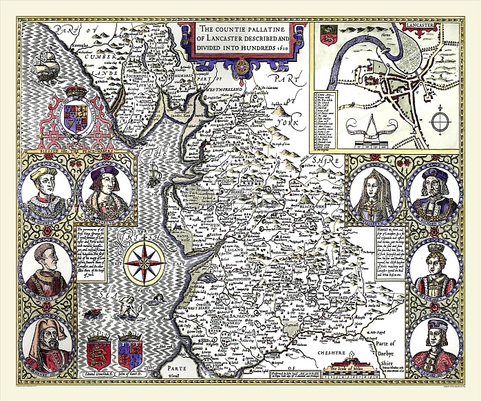
This map by John Speed 1611 of Lancashire is beautifully decorated. As the county is long and narrow, the scale is much smaller than Speed's other maps and the border areas show portraits of prominent figures of the Houses of Lancaster and York, with two short stories of them. The coat of arms of Edward Crouchback, Earl of Lancaster, and John of Gaunt, Duke of Lancaster are also shown. Although Manchester was well established as a textile centre at this time Lancaster's town is depicted on the map probably because its castle was the county headquarters. The map shows Liverpool, a fishing village many years before it transformed into one of the largest and famous sea ports in the World. The inset plan of Lancaster has a legend detailing the streets and main buildings of the town. Ships and sea monsters are shown in the sea area.John Speed, a tailor's son from Cheshire is, perhaps, the most famous of British cartographers and one of the earliest. Whilst in his 50's, aided by his patron, Sir Fulke Greville, he produced 'The Theatre of the Empire of Great Britain', a book of county maps to accompany a history of Great Britain.
| px | px | dpi | = | cm | x | cm | = | MB |
Details
Creative#:
TOP23891733
Source:
達志影像
Authorization Type:
RM
Release Information:
須由TPG 完整授權
Model Release:
No
Property Release:
No
Right to Privacy:
No
Same folder images:
 Loading