
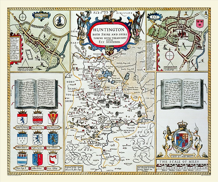
John Speed's map of Huntingdonshire 1611 is very interesting as it is a small county and takes up only the centre of the page. Much of the fen country of Cambridgeshire is included and, also a plan of Huntingdon, and a plan of Ely although it is in Cambridgeshire. The country is covered with windmills and this is the only map of Speed's to show roads, with the Roman Watling and Ermine streets being marked. There is a very decorative title cartouche and the town plans and coats of arms flank this map.
| px | px | dpi | = | cm | x | cm | = | MB |
Details
Creative#:
TOP23891729
Source:
達志影像
Authorization Type:
RM
Release Information:
須由TPG 完整授權
Model Release:
No
Property Release:
No
Right to Privacy:
No
Same folder images:
 Loading