
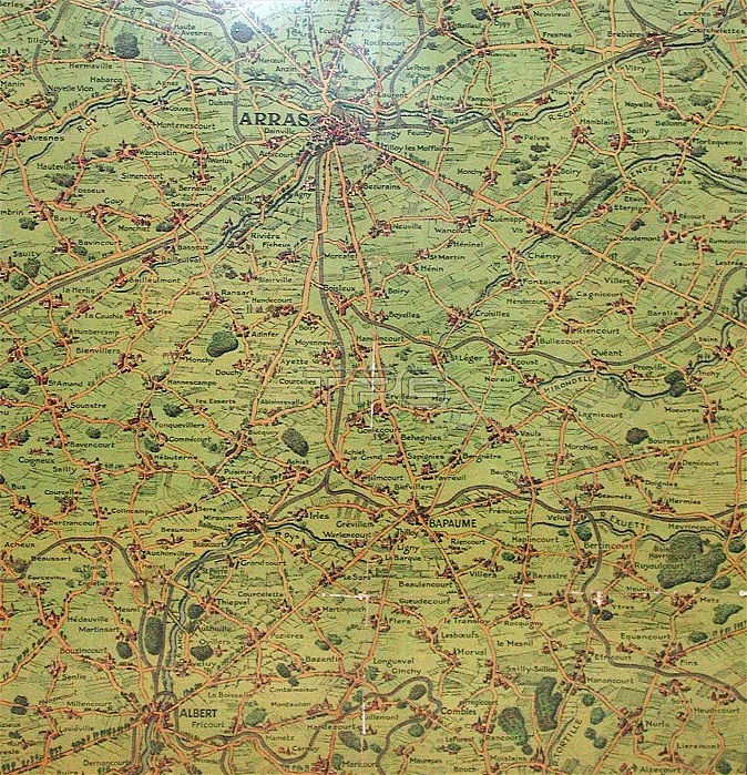
'Daily Mail coloured print of a map of part of the Western Front from Bethune and La Bassee in the North to Albert and Peronne in the South with Arras in the centre of the map. It shows the towns,villages, woods and rivers. Scale = 1" to the mile. English School'
| px | px | dpi | = | cm | x | cm | = | MB |
Details
Creative#:
TOP23877730
Source:
達志影像
Authorization Type:
RM
Release Information:
須由TPG 完整授權
Model Release:
No
Property Release:
No
Right to Privacy:
No
Same folder images:
 Loading