
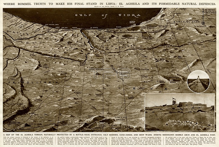
Where Rommel planned to make his final stand in Libya during the Second World War: El Agheila and its formidable natural defences. A map of the El Agheila terrain, naturally protected by a bottleneck entrance, salt marshes, sand dunes and deep wadis. Inset are photos of Mussolini's marble arch and El Agheila fort.
| px | px | dpi | = | cm | x | cm | = | MB |
Details
Creative#:
TOP23848427
Source:
達志影像
Authorization Type:
RM
Release Information:
須由TPG 完整授權
Model Release:
No
Property Release:
No
Right to Privacy:
No
Same folder images:
rommelgermangeneralenemyfinalstandlibyalibyannorthafricaafricangulfsidrasecondworldwartwoww2wwii2ndwartimeelagheilanaturaldefencesmapmapslandterrainprotectedbottleneckentrancesaltmarshesmarshmarshysanddunesdunedeepwadisphotosmussolinimarblearchfort1942davisilndoublepagespreadgeorgehoraceghhistoryhistorical
19422ndafricaafricanagheilaarchbottleneckdavisdeepdefencesdoubleduneduneselenemyentrancefinalfortggeneralgeorgegermangulfhhistoricalhistoryhoraceilnlandlibyalibyanmapmapsmarblemarshmarshesmarshymussolininaturalnorthpagephotosprotectedrommelsaltsandsecondsidraspreadstandterraintwowadiswarwartimeworldww2wwii
 Loading