
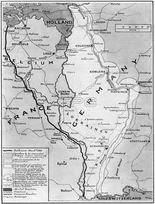
A map illustrating the Armistice at the end of World War One. The black line shows the battle line on Armistice Day, 11th November 1918. Belgium, France, Luxembourg and Alsace-Lorraine are to be evacuated by Germany. The left (west) bank of the Rhine is to be evacuated and will be under control of the Allied and United States Armies of Occupation. A neutral zone on the right (east) bank of the Rhine is to be set up.
| px | px | dpi | = | cm | x | cm | = | MB |
Details
Creative#:
TOP23842475
Source:
達志影像
Authorization Type:
RM
Release Information:
須由TPG 完整授權
Model Release:
No
Property Release:
No
Right to Privacy:
No
Same folder images:
 Loading