
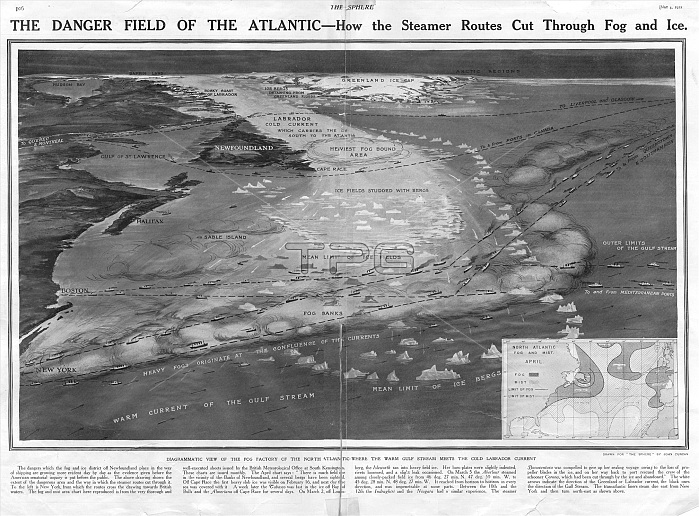
A diagram or map showing the dangerous area of the Atlantic Ocean indicating steamer routes that cut through fog and ice. It was here that the Titanic hit an iceberg on 15 April 1912 and sank with the loss of over 1500 lives. Described here in The Sphere in its report on the disaster as a fog factory, due to the warm gulf stream meeting the cold Labrador current.
| px | px | dpi | = | cm | x | cm | = | MB |
Details
Creative#:
TOP23810978
Source:
達志影像
Authorization Type:
RM
Release Information:
須由TPG 完整授權
Model Release:
No
Property Release:
No
Right to Privacy:
No
Same folder images:
 Loading