
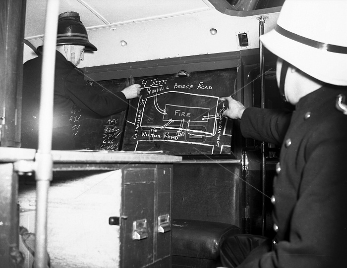
The inside of the control unit and the preparation of the fire ground map, showing the layout of the affected building. It is used for planning the disposition of crews and lines of attack on the fire.
| px | px | dpi | = | cm | x | cm | = | MB |
Details
Creative#:
TOP23802493
Source:
達志影像
Authorization Type:
RM
Release Information:
須由TPG 完整授權
Model Release:
No
Property Release:
No
Right to Privacy:
No
Same folder images:
londonfirebrigadefiremenfiremanfirefighterfirefightinglfbservicevauxhallbridgeroadcommandunitunitsvehiclevehiclestransportfirefighterscontrolinsidepreparationgroundmapblackboardboardchalklayoutbuildingplanningdispositioncrewcrewslinesattack19591950s50sfiftieslccinteriorplanstrategytheofanditforonhistoryhistorical
1950s195950sandattackblackboardboardbridgebrigadebuildingchalkcommandcontrolcrewcrewsdispositionfiftiesfirefirefighterfirefightersfirefightingfiremanfiremenforgroundhistoricalhistoryinsideinterioritlayoutlcclfblineslondonmapofonplanplanningpreparationroadservicestrategythetransportunitunitsvauxhallvehiclevehicles
 Loading