
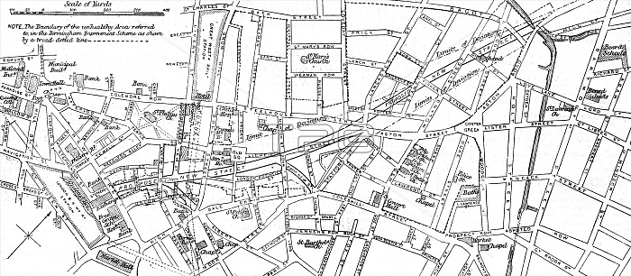
Sketch map of a locality around Stafford Street in Birmingham with the proposed new street running through it. The boundary of the unhealthy area referred to in the Birmingham Improvement Scheme as shown by a broad dotted line.
| px | px | dpi | = | cm | x | cm | = | MB |
Details
Creative#:
TOP23734283
Source:
達志影像
Authorization Type:
RM
Release Information:
須由TPG 完整授權
Model Release:
No
Property Release:
No
Right to Privacy:
No
Same folder images:
 Loading