
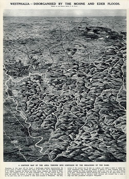
Contour map of the Westphalia region of Germany, with the positions of the Sorpe, Mohne and Eder Dams marked. These were the dams attacked by British RAF Lancaster bombers of 617 Squadron during the Dambuster Raid of 16 May 1943. The map shows how the area was affected by the breaching of the dams.
| px | px | dpi | = | cm | x | cm | = | MB |
Details
Creative#:
TOP23732509
Source:
達志影像
Authorization Type:
RM
Release Information:
須由TPG 完整授權
Model Release:
No
Property Release:
No
Right to Privacy:
No
Same folder images:
westphaliaregiongermanygermansecondworldwartwoww2wwii2ndwartime1943contourmapmapspositionssorpemohneederdamsmarkedattackattackedsuccessraflancasterbombersbomberbombing617squadrondambusterdambustersraid16maybritishalliedalliesareaaffectedbreachingdavisfloodfloodsfloodinggeorgehoraceghdambustersdambustershistoryhistorical
162nd6171943affectedalliedalliesareaattackattackedbomberbombersbombingbreachingbritishbustersbusterscontourdamdamdambusterdambustersdamsdavisederfloodfloodingfloodsggeorgegermangermanyhhistoricalhistoryhoracelancastermapmapsmarkedmaymohnepositionsrafraidregionsecondsorpesquadronsuccesstwowarwartimewestphaliaworldww2wwii
 Loading