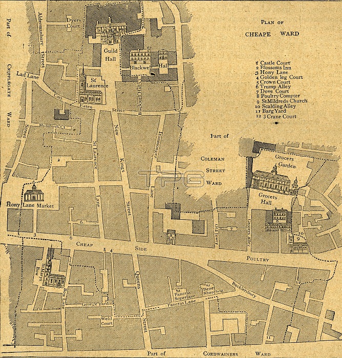
'Old Map of the Ward of Cheap - About 1750', (1897). Map of part of the City of London, showing: Castle Court, Blossoms Inn, Hony Lane, Golden leg Court, Crown Court, Trump Alley, Dove Court, Poultry Compter, St Mildred's Church, Scalding Alley, Barg Yard and Crane Court, as well the Guildhall, Grocers Hall, and the church of St Mary-le-Bow. From Old and New London, Volume I, by Walter Thornbury. [Cassell and Company, Limited, London, Paris & Melbourne, 1897]
| px | px | dpi | = | cm | x | cm | = | MB |
Details
Creative#:
TOP23172714
Source:
達志影像
Authorization Type:
RM
Release Information:
須由TPG 完整授權
Model Release:
No
Property Release:
No
Right to Privacy:
No
Same folder images:
cityroadLondonEnglandjobstreettowncountryoccupationBritishEnglishlaneavenuelocationcenturycityoflondonBritainprofessionwardB&WMONOCHROMEguildhallpublication19thcenturyblack&whiteblackandwhiteB/Wpublisher18thcenturyEighteenthCenturynineteenthcenturyThePrintCollectorCheapsidestreetplanmapOldandNewLondonPrintCollector29ThornburyCassell&CompanyLtdGeorgeWalterThornburyGeorgeWalter
&&18th19thB&WB/WBritainBritishCassellCenturyCheapsideCollectorCollector29CompanyEighteenthEnglandEnglishGeorgeGeorgeLondonLondonLtdMONOCHROMENewOldPrintPrintTheThornburyThornburyWalterWalterandandavenueblackblackcenturycenturycenturycenturycitycitycountryguildhalljoblanelocationlondonmapnineteenthoccupationofplanprofessionpublicationpublisherroadstreetstreettownwardwhitewhite

 Loading