
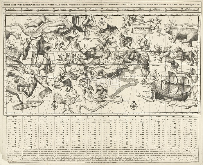
Sky map for the northern and southern skies performed in Mercator projection, Johannes de Broen, unknown, in or after 1709
| px | px | dpi | = | cm | x | cm | = | MB |
Details
Creative#:
TOP22908769
Source:
達志影像
Authorization Type:
RM
Release Information:
須由TPG 完整授權
Model Release:
No
Property Release:
No
Right to Privacy:
No
Same folder images:
1709agedanciennesarkheiaartartsblackandwhiteblack-and-whitebroendedrawingdrawingsengravingengravingsgravureshistorichistoricalhistoricallyhistoryillustrationillustrationsjohanneskupferstichkabinettkupferstich-kabinettmapmapsmastermercatornorthernoldperformedpicturepicturesprintprintsprojectionskiesskysouthernunknownalimdiRM333DRDRJ
1709333DRDRJRMagedalimdianciennesandarkheiaartartsblackblack-and-whitebroendedrawingdrawingsengravingengravingsgravureshistorichistoricalhistoricallyhistoryillustrationillustrationsjohanneskabinettkupferstichkupferstich-kabinettmapmapsmastermercatornorthernoldperformedpicturepicturesprintprintsprojectionskiesskysouthernunknownwhite
 Loading