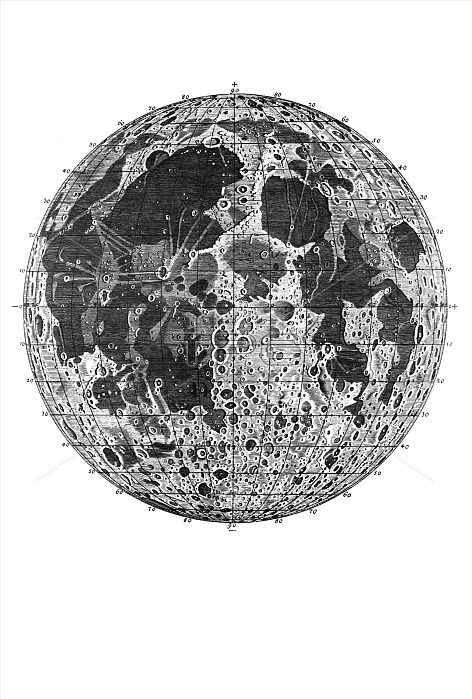
Woodcut, first detailed Moon map with seas, mountain ranges, moon craters and a geographic coordinate system, Johann Tobias Mayer, 1775
| px | px | dpi | = | cm | x | cm | = | MB |
Details
Creative#:
TOP22607627
Source:
達志影像
Authorization Type:
RM
Release Information:
須由TPG 完整授權
Model Release:
No
Property Release:
No
Right to Privacy:
No
Same folder images:
1775agedandartarticlearticlesArtsartsastronomicalastronomybricolagecoordinatecraftedcraftingcraftmanshipcraftscratersdepictiondepictionsdetaileddrawingfigurefiguresfirstgeographicgoodgoodshandhand-craftedhand-madehandicrafthandicraftshandicraftsmanshiphandmadehistorichistoricalhistoricallyhistoryillustrationillustrationsitemitemsJohannmademapMayermethodmethodsmoonMoonmountainnaturalofoldpaintingpaintingspicturepicturesprocedureproceduresrangesrepresentationrepresentationsresearchsciencesciencesscientificseassystemtechniquetechniquestechnologiestechnologyTobiaswithwoodcutWoodcutwoodcutsworkworksxylographxylographsxylography
1775ArtsJohannMayerMoonTobiasWoodcutagedandartarticlearticlesartsastronomicalastronomybricolagecoordinatecraftedcraftingcraftmanshipcraftscratersdepictiondepictionsdetaileddrawingfigurefiguresfirstgeographicgoodgoodshandhand-craftedhand-madehandicrafthandicraftshandicraftsmanshiphandmadehistorichistoricalhistoricallyhistoryillustrationillustrationsitemitemsmademapmethodmethodsmoonmountainnaturalofoldpaintingpaintingspicturepicturesprocedureproceduresrangesrepresentationrepresentationsresearchsciencesciencesscientificseassystemtechniquetechniquestechnologiestechnologywithwoodcutwoodcutsworkworksxylographxylographsxylography

 Loading