
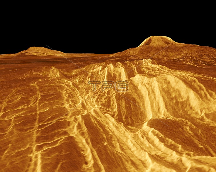
A portion of western Eistla Regio is shown in this three dimensional, computer-generated view of the surface of Venus. Magellan imaging and altimetry data are combined to develop a three-dimensional computer view of the planet's surface. Simulated color based on color images from the Soviet Venera 13 and 14 spacecraft is added to enhance small-scale structure. Magellan is a NASA spacecraft mission to map the surface of Venus with imaging radar. The basic scientific instrument is a synthetic aperture radar, or SAR, which can look through the thick clouds perpetually shielding the surface of Venus. Magellan is in orbit around Venus which completes one turn around its axis in 243 Earth days. That period of time, one Venus day, is the length of a Magellan mapping cycle. The spacecraft completed its first mapping cycle and primary mission on May 15, 1991, and immediately began its second cycle. During the first cycle, Magellan mapped more than 80 percent of the planet's surface and the current and subsequent cycles of equal duration will provide complete mapping of Venus. Magellan was launched May 4, 1989, aboard the space shuttle Atlantis and went into orbit around Venus August 10, 1990.
| px | px | dpi | = | cm | x | cm | = | MB |
Details
Creative#:
TOP22316653
Source:
達志影像
Authorization Type:
RM
Release Information:
須由TPG 完整授權
Model Release:
N/A
Property Release:
No
Right to Privacy:
No
Same folder images:
 Loading