
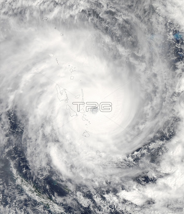
This satellite image shows the eye of Cyclone Pam heading in a southwesterly direction on March 13, 2015, shortly before the storm struck the South Pacific island nation of Vanuatu (outlined). Cyclone Pam has since left thousands of people homeless and destroyed most of the buildings in Port Vila, Vanuatu's capital city. As the storm approached the city, it had sustained winds up to 265 kilometers (165 miles) per hour, making it the equivalent of a category 5 cyclone.
| px | px | dpi | = | cm | x | cm | = | MB |
Details
Creative#:
TOP22315500
Source:
達志影像
Authorization Type:
RM
Release Information:
須由TPG 完整授權
Model Release:
N/A
Property Release:
No
Right to Privacy:
No
Same folder images:
 Loading