
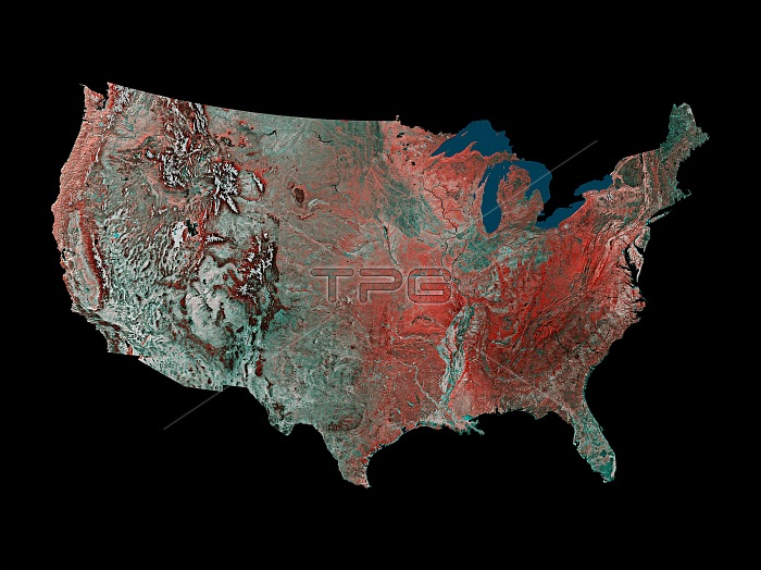
This United States is a mosaic prepared by using 16 images from the Advanced Very High Resolution Radiometer (AVHRR) sensors on the meteorological satellites NOAA-8 and NOAA-9. The images were taken between May 24, 1984 and May 14, 1986. On false-color infrared mosaics, vegetation appears in red instead of green. The "redness" indicates vegetation density, type and whether growing on dry land or in a swamp. Grasslands appear light red, deciduous trees and croplands appear red, and coniferous forests appear dark red or maroon. Desert areas appear white and urban areas appear bluish green. Lakes, rivers and oceans appear in various shades of blue, dark blue for deep water and light blue for shallow or turbid water.
| px | px | dpi | = | cm | x | cm | = | MB |
Details
Creative#:
TOP22315071
Source:
達志影像
Authorization Type:
RM
Release Information:
須由TPG 完整授權
Model Release:
N/A
Property Release:
No
Right to Privacy:
No
Same folder images:
 Loading