
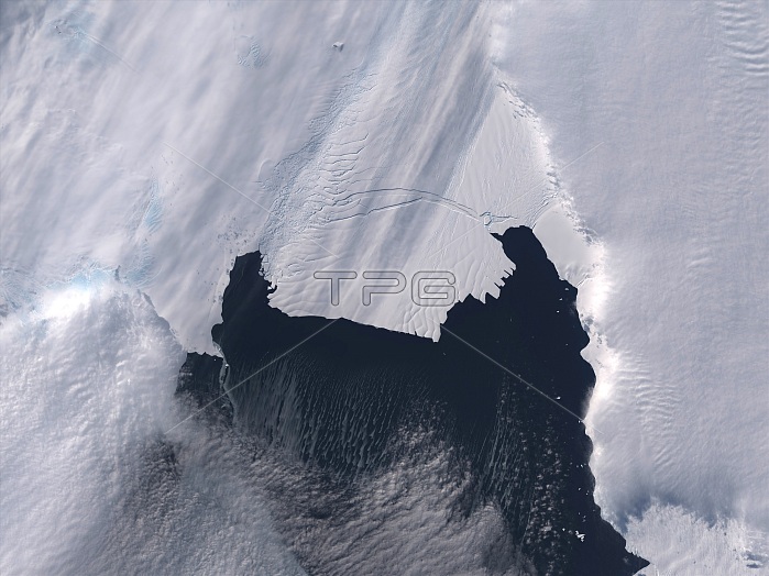
Between November 9th and 11th, 2013, a large iceberg finally separated from the calving front of Antarctica's Pine Island Glacier. Scientists first detected a rift in the glacier in October 2011 during flights for NASA's Operation IceBridge. By July 2013, infrared and radar images indicated that the crack had cut completely across the ice shelf to the southwestern edge. New images now show that Iceberg B-31 is finally moving away from the coast, with open water between the iceberg and the edge of Pine Island Glacier. Named B-31 by the U.S. National Ice Center, the new iceberg is estimated to be 35 kilometers by 20 kilometers (21 by 12 miles), roughly the size of Singapore.
| px | px | dpi | = | cm | x | cm | = | MB |
Details
Creative#:
TOP22314592
Source:
達志影像
Authorization Type:
RM
Release Information:
須由TPG 完整授權
Model Release:
N/A
Property Release:
No
Right to Privacy:
No
Same folder images:
 Loading