
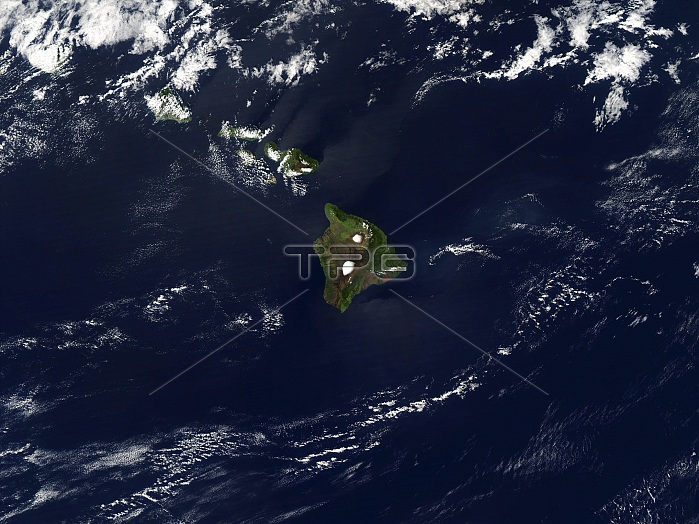
Satellite image of the islands of the state of Hawaii, in the Pacific Ocean. North is at top. Center is the Big Island, while curving left from this are Maui, Lana'i, Molokai, O'ahu and Kaua'i (twin island). The windward side (northeast) of each island is lusher than that of the leeward sides (southwest). This is due to the greater amount of rainfall brought by wind. The islands lie on a "hot spot", an unusually hot region of the Earth's mantle. An undersea volcano south east of Big Island may one day create a new island.
| px | px | dpi | = | cm | x | cm | = | MB |
Details
Creative#:
TOP22314378
Source:
達志影像
Authorization Type:
RM
Release Information:
須由TPG 完整授權
Model Release:
N/A
Property Release:
No
Right to Privacy:
No
Same folder images:
 Loading