
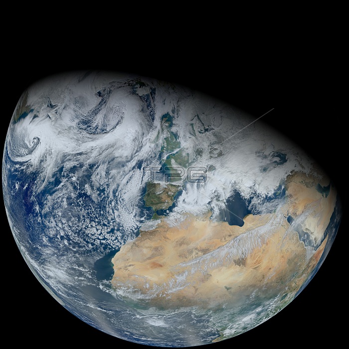
Over a period of six orbits on on February 3, 2012, the recently launched Suomi NPP satellite provided the Visible Infrared Imaging Radiometer Suite (VIIRS) instrument enough time to gather the pixels for this synthesized view of Earth showing North Africa and southwestern Europe.
| px | px | dpi | = | cm | x | cm | = | MB |
Details
Creative#:
TOP22314282
Source:
達志影像
Authorization Type:
RM
Release Information:
須由TPG 完整授權
Model Release:
N/A
Property Release:
No
Right to Privacy:
No
Same folder images:
 Loading