
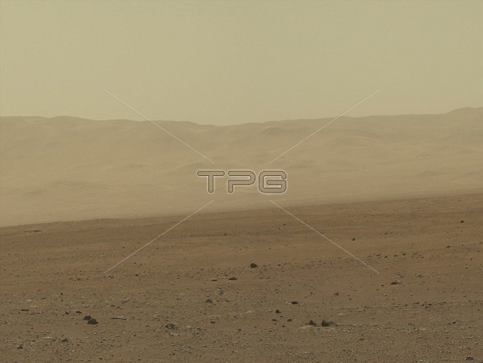
A color mosaic captured by Curiosity's Mast Camera shows Gale Crater on Mars located where it landed on August 5, 2012 PDT. August 6, 2012 EDT. This image of the crater wall is north of the landing site, or behind the rover. These valleys are believed to have formed by water erosion enters Gale Crater from the outside. This is the first view scientists have had of a fluvial system, one relating to a river or stream from the surface of Mars. Known and studied since the 1970s beginning with NASA's Viking missions, such networks date from a period in Martian history when water flowed freely across the surface. The main channel deposit seen here resembles a dirt road ascending into the mountains, which are actually the north wall and rim of Gale Crater. Although Curiosity is about 11 miles (18 kilometers) away from this area and the view is obscured somewhat by dust and haze, the image provides new insights into the style of sediment transport within this system. Curiosity has no current plans to visit this valley system, since the primary objective of the rover is south of the landing site. Image was taken on August 8, 2012.
| px | px | dpi | = | cm | x | cm | = | MB |
Details
Creative#:
TOP22312743
Source:
達志影像
Authorization Type:
RM
Release Information:
須由TPG 完整授權
Model Release:
N/A
Property Release:
No
Right to Privacy:
No
Same folder images:
 Loading