
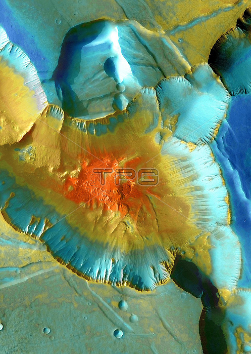
This image from NASA's Mars Odyssey spacecraft shows the checkerboard region of Noctis Labyrinthus, the Labyrinth of Night. Scientists believe that this feature began to develop when volcanic activity stirred in the adjoining region of Tharsis, stretching the Martian crust and fracturing it. As cracks and faults opened, ice and water in the subsurface escaped, making the ground collapse. The result today is a tangle of tablelands cut by canyons, troughs, and pits. This false-color Thermal Emission Imaging System (THEMIS) mosaic focuses on one junction where canyons meet to form a depression 4 kilometers (13,000 feet) deep. The nighttime view records the predawn temperature of the surface. Dark streaks mark the paths of sand or dust avalanches. At the foot of the slope lie traces of older, more substantial avalanches that piled up rocks and large debris.
| px | px | dpi | = | cm | x | cm | = | MB |
Details
Creative#:
TOP22310227
Source:
達志影像
Authorization Type:
RM
Release Information:
須由TPG 完整授權
Model Release:
N/A
Property Release:
No
Right to Privacy:
No
Same folder images:
 Loading