
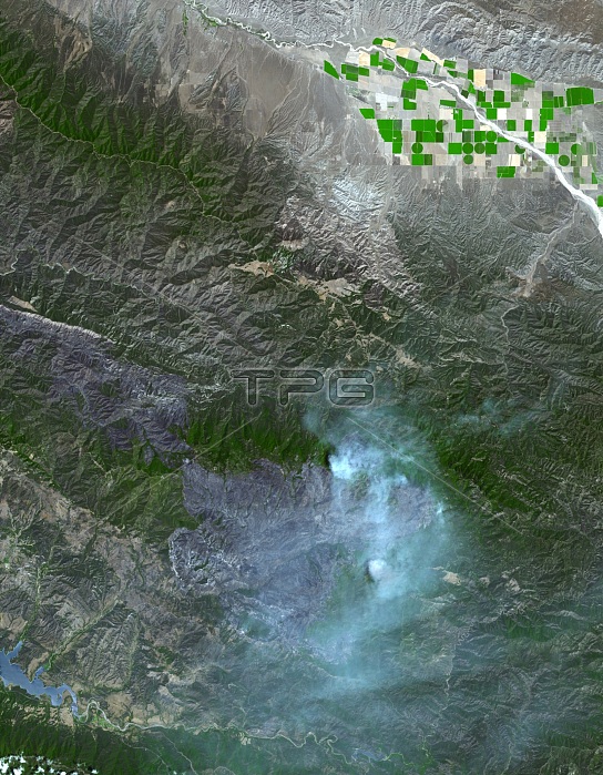
In early August 2007, the month-old Zaca Fire in Southern California was racing over the hilly terrain along the southwest margin of the Los Padres National Forest. Started accidentally on private ranch land near the forest in early July, the fire quickly got out of control in the hot, dry, windy conditions the area was experiencing in summer 2007. As of August 8, the fire had burned an estimated 72,050 acres and was about 68 percent contained. This image of the fire was captured by the Advanced Spaceborne Thermal Emission and Reflection Radiometer (ASTER) on NASA's Terra satellite on August 7. Unburned vegetation appears green, while the burned area appears charcoal-colored. Smoke hangs over the area.
| px | px | dpi | = | cm | x | cm | = | MB |
Details
Creative#:
TOP22309898
Source:
達志影像
Authorization Type:
RM
Release Information:
須由TPG 完整授權
Model Release:
N/A
Property Release:
No
Right to Privacy:
No
Same folder images:
 Loading