
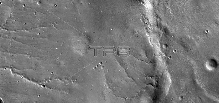
View shows the ground covered in the first image of Mars taken by the HiRISE camera on NASA's Mars Reconnaissance Orbiter. HiRISE took this first test image from orbit on March 24, 2006, from an altitude of 1,547 miles. Images taken during the mission's main science phase, beginning in fall 2006, will be from an altitude about one-tenth as far from the ground, gaining even higher resolution. This image is a mosaic combining 10 side-by-side exposures taken through red filters, presented at greatly reduced scale. The full product would be 20,000 pixels wide by 9,500 pixels high. The quality of this test image is spectacular, with no hint to the eye of any smear or blurring. An old, muted crater lies at the middle of the scene, with sets of channels to the left and right. Superimposed on parts of this terrain is a much younger, layered mantle of debris. The debris mantle is smooth in places but rough in other areas where it may have partially sublimated. This suggests that the debris mantle is (or was) rich in volatiles such as ices of water, carbon dioxide or both.
| px | px | dpi | = | cm | x | cm | = | MB |
Details
Creative#:
TOP22309760
Source:
達志影像
Authorization Type:
RM
Release Information:
須由TPG 完整授權
Model Release:
No
Property Release:
No
Right to Privacy:
No
Same folder images:
 Loading