
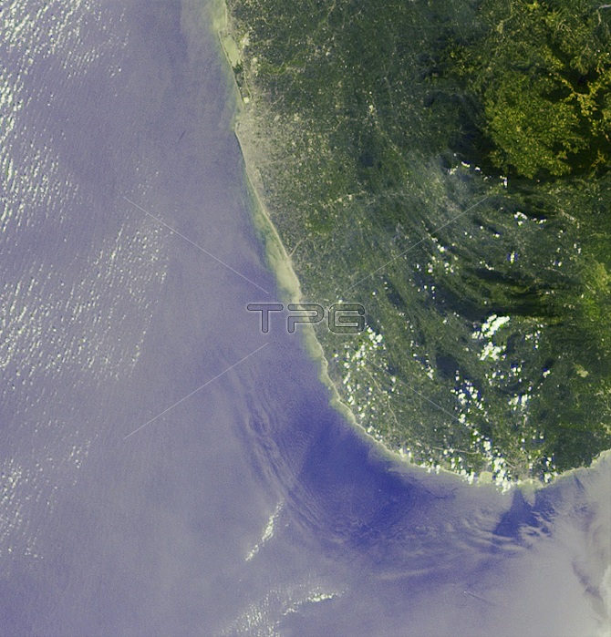
The initial tsunami waves resulting from the undersea earthquake that occurred at 00:58:53 UTC December 26, 2004 off the island of Sumatra, Indonesia, took a little over 2 hours to reach the teardrop-shaped island of Sri Lanka. Additional waves continued to arrive for many hours afterward. At approximately 05:15 UTC, as NASA's Terra satellite passed overhead, the Multi-angle Imaging SpectroRadiometer (MISR) captured this image of deep ocean tsunami waves about 30-40 kilometers from Sri Lanka's southwestern coast. The waves are made visible due to the effects of changes in sea-surface slope on the reflected sunglint pattern, shown here in MISR's 46簞 forward-pointing camera.
| px | px | dpi | = | cm | x | cm | = | MB |
Details
Creative#:
TOP22287536
Source:
達志影像
Authorization Type:
RM
Release Information:
須由TPG 完整授權
Model Release:
N/A
Property Release:
No
Right to Privacy:
No
Same folder images:
 Loading