
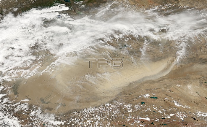
A dust storm formed in the Taklimakan Desert In China. The Moderate Resolution Imaging Spectroradiometer (MODIS) on NASA's Aqua satellite took this picture on May 19, 2007. This image shows the eastern end of the desert where a dust plume pushes past the southeastern edge. Over the land south of the desert, the dust contrasts strongly, thanks to its light color. Over the desert floor, the dust blends in with the sands below. Toward the northeast, the dust plume mixes with clouds. Also in the northeast are small patches of pale blue. Their straight edges imply that these features are made by humans, perhaps a salt mine. Due to a lack of drainage, salt collects in the Taklimakan Desert, whose lowest point is roughly 150 meters (490 feet) below sea level. The desert lies in the Tarim Basin, between the Tien Shan Mountains to the north and Kunlun Mountains to the south, and it is home to one of the world's largest shifting-sand deserts.
| px | px | dpi | = | cm | x | cm | = | MB |
Details
Creative#:
TOP22287529
Source:
達志影像
Authorization Type:
RM
Release Information:
須由TPG 完整授權
Model Release:
N/A
Property Release:
No
Right to Privacy:
No
Same folder images:
 Loading