
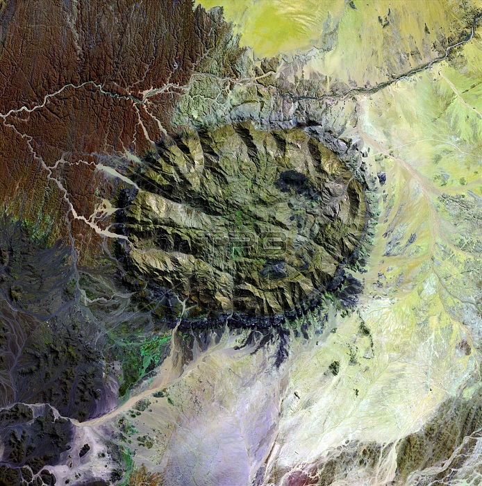
Brandberg Massif, satellite image. North is at top. This massif (center) rises 2606 meters above the deserts of northern Namibia. It is a mass of granite that formed by underground volcanic processes (a granite plug) and rose to the surface of the Earth around 120 million years ago. Plant and animal communities unique to the area thrive in its high-altitude environment, and prehistoric cave paintings decorate walls hidden in its steep cliffs. Several dry river beds are seen in the surrounding desert landscape. The area shown in this image is around 60 kilometers wide. The image data was obtained on 10 September 2002, by the Landsat 7 satellite.
| px | px | dpi | = | cm | x | cm | = | MB |
Details
Creative#:
TOP22287113
Source:
達志影像
Authorization Type:
RM
Release Information:
須由TPG 完整授權
Model Release:
No
Property Release:
No
Right to Privacy:
No
Same folder images:
 Loading