
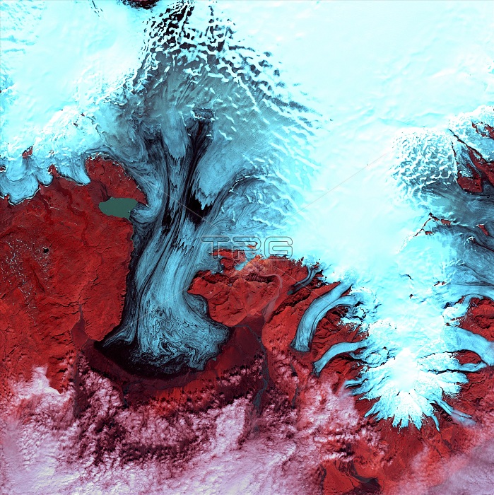
Vatnajokull Glacier, satellite image. North is at top. Vegetation is red, snow is white and ice is blue. Clouds (white) are seen across bottom. This is the southern part of Vatnajokull Glacier in Iceland's Skaftafell National Park. The 'glacier' is Europe's largest icecap. True glaciers are seen here, as tongues of ice (blue) flowing down from the icecap to lower levels where they melt. Off the edge of the image, at lower right, is the coast, where the glaciers are producing icebergs. The area shown in this image is around 60 kilometers wide. The image data includes infrared wavelengths, and was obtained on 4 August 1999, by the Landsat 7 satellite.
| px | px | dpi | = | cm | x | cm | = | MB |
Details
Creative#:
TOP22287109
Source:
達志影像
Authorization Type:
RM
Release Information:
須由TPG 完整授權
Model Release:
No
Property Release:
No
Right to Privacy:
No
Same folder images:
 Loading