
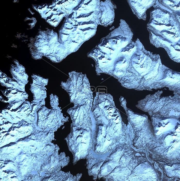
Norwegian fjords, satellite image. North is at top. Water is black, snow is white and ice is blue. Glaciers (blue) are seen in several of the valleys, carrying ice down from the mountains to the sea. Fjords are narrow coastal inlets, carved by glaciers, and then flooded by the sea level rise at the end of the last Ice Age. They can be hundreds of meters deep, and are here surrounded by towering mountains. These fjords are in northern Norway, just south-west of Tromso. The area shown in this image is around 60 kilometers wide. The image data includes infrared wavelengths, and was obtained on 17 April 2002, using the ASTER sensor on the Terra satellite.
| px | px | dpi | = | cm | x | cm | = | MB |
Details
Creative#:
TOP22287100
Source:
達志影像
Authorization Type:
RM
Release Information:
須由TPG 完整授權
Model Release:
No
Property Release:
No
Right to Privacy:
No
Same folder images:
 Loading