
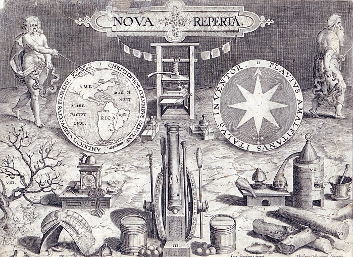
Map of the Western Hemisphere. Title plate to Nova Reperta, a series of engravings after drawings by Stradanus published by Galle in Antwerp. Shows Christopher Columbus pointing to a map of the Western Hemisphere. New France and Florida are indicated in North America. In addition to the map, notable developments in science and technology of the late 16th century are illustrated.
| px | px | dpi | = | cm | x | cm | = | MB |
Details
Creative#:
TOP22174205
Source:
達志影像
Authorization Type:
RM
Release Information:
須由TPG 完整授權
Model Release:
N/A
Property Release:
No
Right to Privacy:
No
Same folder images:
bw16thcentury1590s1590stradanusillustrationengravingdrawingartworkartnovarepertatitlepagewesternhemispherevoyageroutemappingmapjourneycoursecolumbuschristoffacorombochristophoruscolumbuscristovaocolombocristobalcoloncristoforcolomcristoforocolombochristophercolumbusmenmalemanpersonalitiespeoplepersonalitypersonfigurewell-knownnotableimportantfamoushistoricalhistorichistorygeographicalgeographicgeographycartographyageofdiscoverynavigationexploration
15901590s16thageartartworkbwcartographycenturychristoffachristopherchristophoruscolomcolombocolombocoloncolumbuscolumbuscolumbuscorombocoursecristobalcristoforcristoforocristovaodiscoverydrawingengravingexplorationfamousfiguregeographicgeographicalgeographyhemispherehistorichistoricalhistoryillustrationimportantjourneymalemanmapmappingmennavigationnotablenovaofpagepeoplepersonpersonalitiespersonalityrepertaroutestradanustitlevoyagewell-knownwestern
 Loading