
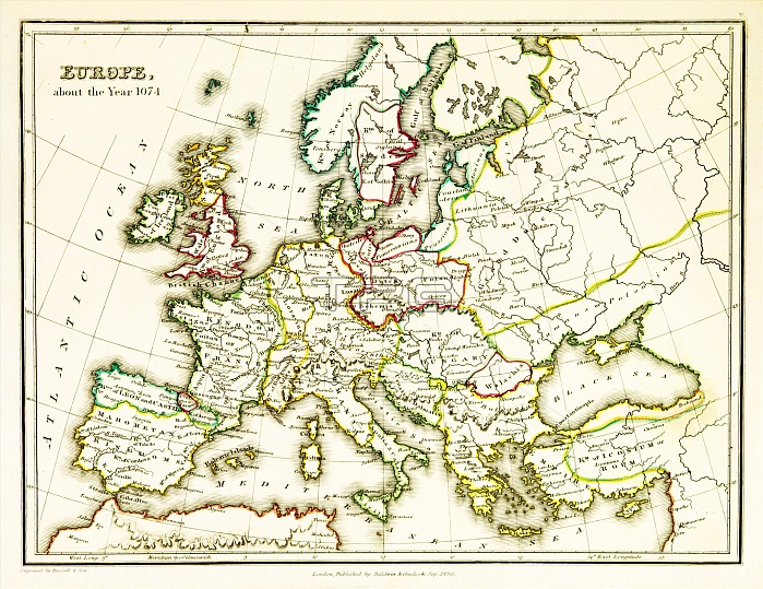
A map of Europe, showing territorial borders existing in the 11th century, specifically in 1074. The Treaty of Gerstungen was concluded on 2 February 1074 in Gerstungen Castle on the River Werra in what is now Germany. It required King Henry IV to restore the Duke Otto of Northeim to the Duchy of Bavaria. In 1073 the latter had successfully headed the rebellion of the Saxons. Map published in 1831.
| px | px | dpi | = | cm | x | cm | = | MB |
Details
Creative#:
TOP22169080
Source:
達志影像
Authorization Type:
RM
Release Information:
須由TPG 完整授權
Model Release:
N/A
Property Release:
No
Right to Privacy:
No
Same folder images:
 Loading