
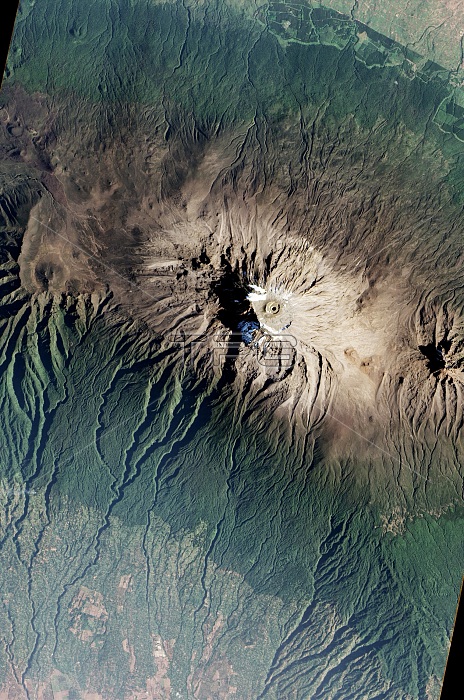
Mount Kilimanjaro, acquired on January 20, 2017, by the Advanced Land Imager (ALI) on NASA's Earth Observing-1 satellite, showing the different zones of vegetation, including farmland on the dry savanna, rainforest, scrublands, and icy summit.
| px | px | dpi | = | cm | x | cm | = | MB |
Details
Creative#:
TOP22096569
Source:
達志影像
Authorization Type:
RM
Release Information:
須由TPG 完整授權
Model Release:
N/A
Property Release:
No
Right to Privacy:
No
Same folder images:
calderavolcanicventvolcanopeaksummittopmountaintopearthobserving-1aliadvancedlandimagerkilimanjaronationalparkalpinedesertmontaneforestplantcommunitieszonationvegetationzonesbiomehabitatenvironmentgeographicgeography2017fromaboveimageryobservationphotosatellitephotographyaerialearthfromspaceearthsciencelandscapelandformgeologicalgeologicformationgeologyafricanafricatanzaniantanzaniamtkilimanjaroaerialviewsatelliteimagemountainkilimanjaromountkilimanjaro
2017aboveadvancedaerialaerialafricaafricanalialpinebiomecalderacommunitiesdesertearthearthearthenvironmentforestformationfromfromgeographicgeographygeologicgeologicalgeologyhabitatimageimagerimagerykilimanjarokilimanjarokilimanjarokilimanjarolandlandformlandscapemontanemountmountainmountaintopmtnationalobservationobserving-1parkpeakphotophotographyplantsatellitesatellitesciencespacesummittanzaniatanzaniantopvegetationventviewvolcanicvolcanozonationzones
 Loading