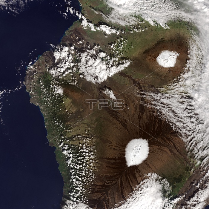
Mauna Kea (top) and Mauna Loa with fresh caps of snow, as seen by the Operational Land Imager (OLI) on the Landsat 8 satellite on December 25, 2016. The storm was on December 18, and came with moist southwest winds, thunder and lightning. Mauna Kea is a little higher and steeper than the still-active Mauna Loa.
| px | px | dpi | = | cm | x | cm | = | MB |
Details
Creative#:
TOP22096394
Source:
達志影像
Authorization Type:
RM
Release Information:
須由TPG 完整授權
Model Release:
N/A
Property Release:
No
Right to Privacy:
No
Same folder images:
oldlavaflowriftzonecalderamokuaweoweomoku'aweoweo2016imageryobservationlandsatphotosatellitephotographyaerialearthfromspaceearthsciencelandscapelandformgeographygeologyoperationallandimagerolilandsat8landsatpacificamericaamericanunitedstatesusausbigislandhawaiianislandshawai'ishieldvolcanovolcanicpeaksummitmountaintopmountaintopwinterweatherfreshsnowsnow-coveredsnowycratersnowvolcanoaerialviewsatelliteimagesnow-cappedhawaiimaunaloamaunakea
82016aerialaerialamericaamericanbigcalderacraterearthearthflowfreshfromgeographygeologyhawai'ihawaiihawaiianimageimagerimageryislandislandskealandlandformlandsatlandsatlandsatlandscapelavaloamaunamaunamoku'aweoweomokuaweoweomountainmountaintopobservationoldolioperationalpacificpeakphotophotographyriftsatellitesatellitescienceshieldsnowsnowsnow-cappedsnow-coveredsnowyspacestatessummittopunitedususaviewvolcanicvolcanovolcanoweatherwinterzone

 Loading