
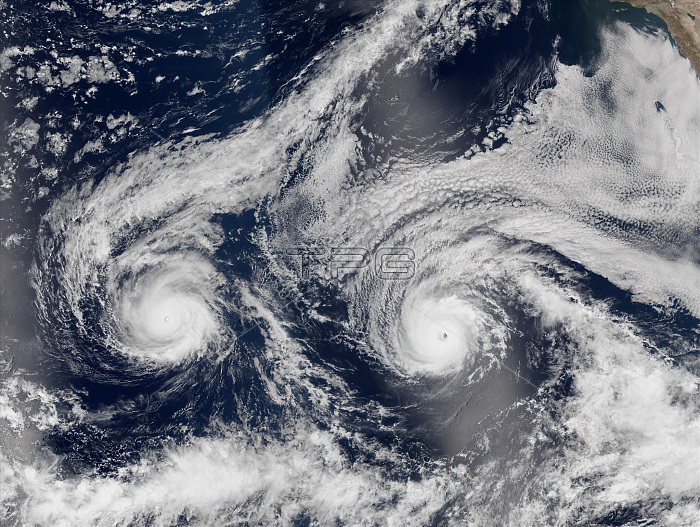
This natural-color image is a composite built from two overpasses by the Visible Infrared Imaging Radiometer Suite (VIIRS) on the Suomi NPP satellite on August 29, 2016. At the time, Hurricane Madeline and Hurricane Lester were both hovering between category 3 and 4 storms. At 11 a.m. Hawaii Standard Time on August 30, Madeline was centered 370 miles east-southeast of Hilo, Hawaii, and had sustained wind speeds of 115 miles (185 kilometers) per hour. At the same time, Lester's wind speed was 120 mph (195 kmph) and its position was 1,300 miles east of Hilo. Ultimately, Madeline and Lester weakened over the following days and did not make landfall.
| px | px | dpi | = | cm | x | cm | = | MB |
Details
Creative#:
TOP22096129
Source:
達志影像
Authorization Type:
RM
Release Information:
須由TPG 完整授權
Model Release:
N/A
Property Release:
No
Right to Privacy:
No
Same folder images:
 Loading