
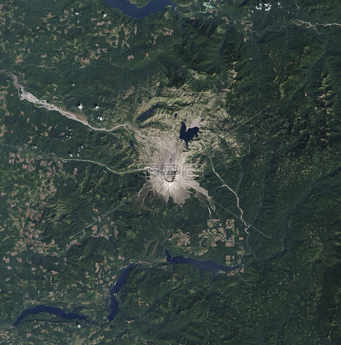
This image shows the area around Mount St. Helens on August 20, 2013, as captured by the Operational Land Imager (OLI) on the Landsat 8 satellite. With water, sunlight, and time, vegetation came back to the Mount St. Helens National Volcanic Monument. On May 18, 1980, a volcanic eruption obliterated the landscape around Mount St. Helens. Entire forests were mowed down by the blast wave. The land surface was sterilized by heat and noxious gas, and then buried under tens of meters of ash, mud, and rock. Nearly every living creature perished within a few miles of the collapsed mountain. But some traces of life survived beneath the debris. Seeds, spores, gophers, fungi. Other flora and fauna survived just beyond the edge of the blighted landscape. In just a few years, natural colonists reclaimed some of the land. In three decades, they have paved over the destruction with robust green.
| px | px | dpi | = | cm | x | cm | = | MB |
Details
Creative#:
TOP22091738
Source:
達志影像
Authorization Type:
RM
Release Information:
須由TPG 完整授權
Model Release:
N/A
Property Release:
No
Right to Privacy:
No
Same folder images:
 Loading