
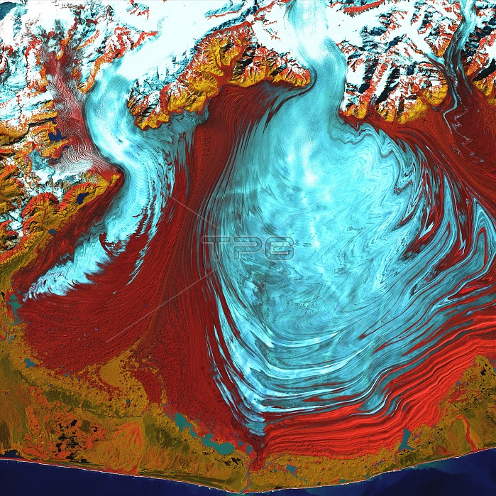
Malaspina Glacier, Alaska, USA, satellite image. The glacial ice (blue) has spread out to form a large rounded shape (centre right). The ice flowed down from the snow-covered mountains (across top, white), to spread out over the lowland area (red). This is an example of a piedmont glacier. Another glacier is seen at upper left. The ice is flowing downhill towards the coast (along bottom). The Malaspina Glacier lies west of Yakutat Bay on the Pacific coast near the Alaska-Canada border. The glacier covers an area of 3880 square kilometres. Image acquired in visible and infrared wavelengths on 31 August 2000 the Landsat 7 satellite.
| px | px | dpi | = | cm | x | cm | = | MB |
Details
Creative#:
TOP22082827
Source:
達志影像
Authorization Type:
RM
Release Information:
須由TPG 完整授權
Model Release:
N/A
Property Release:
No
Right to Privacy:
No
Same folder images:
 Loading