
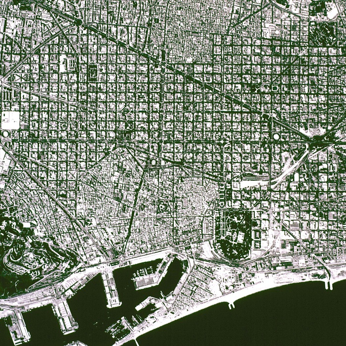
Aerial View of 'L'Eixample' map, know as 'Plan Cerd?' of the city of Barcelona, ??renovation and expansion that took place in 1860.
| px | px | dpi | = | cm | x | cm | = | MB |
Details
Creative#:
TOP21264131
Source:
達志影像
Authorization Type:
RM
Release Information:
須由TPG 完整授權
Model Release:
No
Property Release:
No
Right to Privacy:
No
Same folder images:
 Loading