
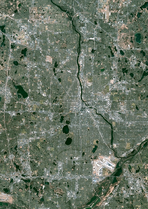
Color satellite image of Minneapolis, Minnesota, United States. The Mississippi River flows through the city. Minneapolis?Saint Paul International Airport is at south. Image collected on November 18, 2017 by Sentinel-2 satellites.
| px | px | dpi | = | cm | x | cm | = | MB |
Details
Creative#:
TOP21177757
Source:
達志影像
Authorization Type:
RM
Release Information:
須由TPG 完整授權
Model Release:
No
Property Release:
No
Right to Privacy:
No
Same folder images:
 Loading