
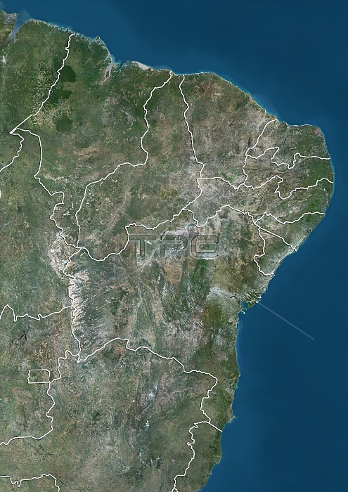
Satellite view of the Northeast Region of Brazil (with administrative boundaries). It is composed of the states of Maranhao, Piaui, Ceara, Rio Grande do Norte, Paraiba, Pernambuco, Alagoas, Sergipe and Bahia. This image was compiled from data acquired by Landsat satellites.
| px | px | dpi | = | cm | x | cm | = | MB |
Details
Creative#:
TOP21176980
Source:
達志影像
Authorization Type:
RM
Release Information:
須由TPG 完整授權
Model Release:
No
Property Release:
No
Right to Privacy:
No
Same folder images:
 Loading