
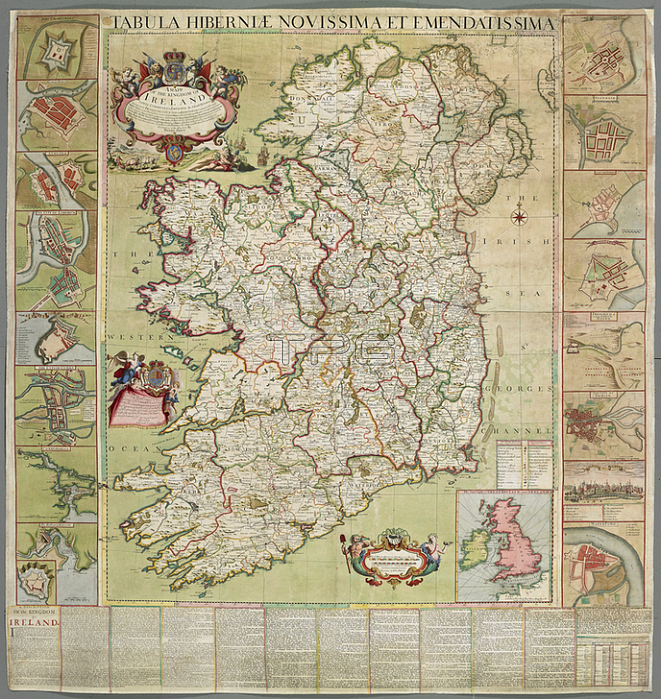
John Harris.A map of Ireland; dated 1708. 1 map on 4 sheets: hand col. ; 135 x 143 cm.; Scala. Irish miles; 50[ = 11 1/4 inches].London: Henry Pratt; 1708.From: Henry Pratt; Tabula Hiberniae novissima et emendatissima. A Mapp of the Kingdom of Ireland newly corrected & improved by actuall observations. Divided into its Provinces Counties & Baronies. also a short description of the Kingdom.Maps K. Top 51.18.11 TAB ENDLondon; British Library.
| px | px | dpi | = | cm | x | cm | = | MB |
Details
Creative#:
TOP21015388
Source:
達志影像
Authorization Type:
RM
Release Information:
須由TPG 完整授權
Model Release:
No
Property Release:
No
Right to Privacy:
No
Same folder images:
Restriction:
Additional permissions needed for non-editorial use.
 Loading