
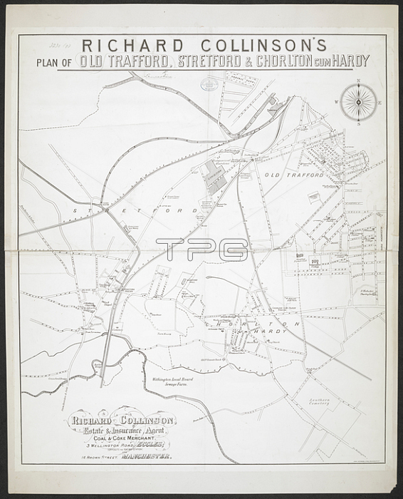
A plan of Old Trafford; Stretford and Chorlton-cum-Hardy.1887.From: R. Collinson's Plan of Old Trafford; Stretford and Chorlton-cum-Hardy. [Scale; circa 6 inches = 1 mile].Maps 3230. (9.)London; British Library.
| px | px | dpi | = | cm | x | cm | = | MB |
Details
Creative#:
TOP21015334
Source:
達志影像
Authorization Type:
RM
Release Information:
須由TPG 完整授權
Model Release:
No
Property Release:
No
Right to Privacy:
No
Same folder images:
Restriction:
Additional permissions needed for non-editorial use.
 Loading