
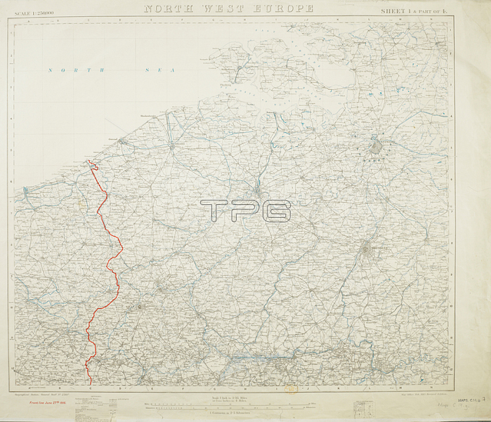
First World War map of north west Europe. Shown in red; is the front line; as of June 27; 1916. 730 x 610 mm.; Scale 1: 250 000.[London]: [Geographical Section; General Staff]; 1917.From: North West Europe. Scale; 1: 250; 000. or 1?14 inches to 4 miles. Sheet 1 and part of 4. [Showing] Front line; June 27th; 1916; [from Nieuport to Lens].Maps. c. 14. g. sheet 1 of 4London; British Library.
| px | px | dpi | = | cm | x | cm | = | MB |
Details
Creative#:
TOP21015012
Source:
達志影像
Authorization Type:
RM
Release Information:
須由TPG 完整授權
Model Release:
No
Property Release:
No
Right to Privacy:
No
Same folder images:
Restriction:
Additional permissions needed for non-editorial use.
 Loading