
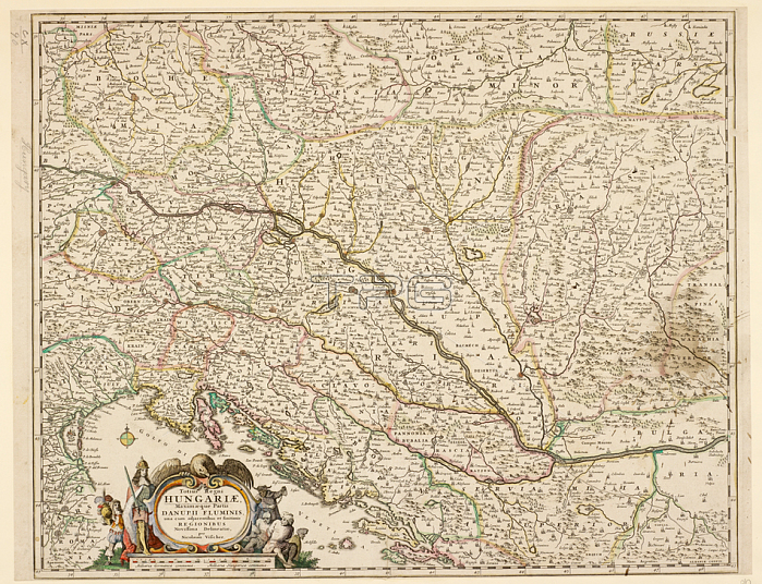
Nicholas Visscher.A map of the Kingdom of Hungary and part of the Danube river.[Amsterdam]; [1680?].From: Nicholas Visscher; Totius Regni Hungariae maximaque partis Danubii fluminis. novissima delineatio.Maps K. Top. 110.90London; British Library.
| px | px | dpi | = | cm | x | cm | = | MB |
Details
Creative#:
TOP21014604
Source:
達志影像
Authorization Type:
RM
Release Information:
須由TPG 完整授權
Model Release:
No
Property Release:
No
Right to Privacy:
No
Same folder images:
Restriction:
Additional permissions needed for non-editorial use.
 Loading