
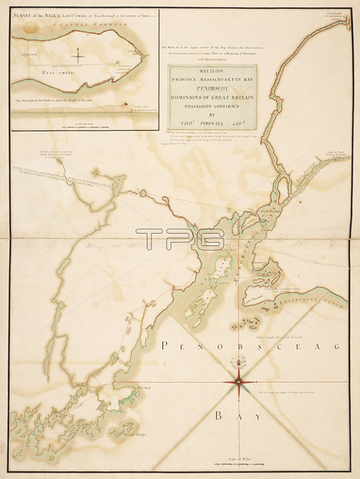
A plan of Massachusetts Bay and part of the River Penobscot.[Place of production not identified]: [by --- Jones; Capt. North; of George's fort; in 1758; and Lieut. Jo. Small; of Scarborough]; 1759.From: MAY 23. 1759. PROVINCE MASSACHUSETTS BAY PENOBSCOT DOMINIONS OF GREAT BRITAIN POSSESSION CONFIRM'D BY THOS. POWNALL GOVR.Maps K. Top. 120.22London; British Library.
| px | px | dpi | = | cm | x | cm | = | MB |
Details
Creative#:
TOP21014602
Source:
達志影像
Authorization Type:
RM
Release Information:
須由TPG 完整授權
Model Release:
No
Property Release:
No
Right to Privacy:
No
Same folder images:
Restriction:
Additional permissions needed for non-editorial use.
 Loading