
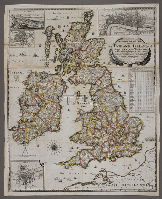
Wenceslaus Hollar.A map of Great Britain and Ireland.London: Ro. Walton; 1654.From: Wenceslaus Hollar; A Curious New and Plaine Mapp of England; Ireland; Scotland and Wales. engraven by W. Hollar. English miles; 80[ = 76 mm.]. With inset plans of Westminster; Edinburgh; Oxford and Dublin].Maps 188. m. 2London; British Library.
| px | px | dpi | = | cm | x | cm | = | MB |
Details
Creative#:
TOP21014570
Source:
達志影像
Authorization Type:
RM
Release Information:
須由TPG 完整授權
Model Release:
No
Property Release:
No
Right to Privacy:
No
Same folder images:
Restriction:
Additional permissions needed for non-editorial use.
 Loading