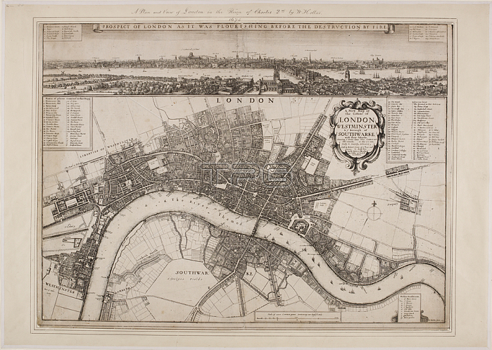
Wenceslaus Hollar.A 17th century map of London; covering Westminster and Southwark.London: sold by Robert Green at ye Rose and Crown in Budg. Row. And by Robert Morden; at ye Atlas in Cornhill; 1675.From: Wenceslaus Hollar; A new map of the citties of London Westminster & ye borough of Southwarke; with their suburbs: shewing ye streets; lanes; allies; courts etc. with othe [sic] remarks; as they are now; trully & carefully delineated / W. Hollar fecit. 1675.Crace Portolio 2.55London; British Library.
| px | px | dpi | = | cm | x | cm | = | MB |
Details
Creative#:
TOP21012468
Source:
達志影像
Authorization Type:
RM
Release Information:
須由TPG 完整授權
Model Release:
No
Property Release:
No
Right to Privacy:
No
Same folder images:
Restriction:
Additional permissions needed for non-editorial use.

 Loading