
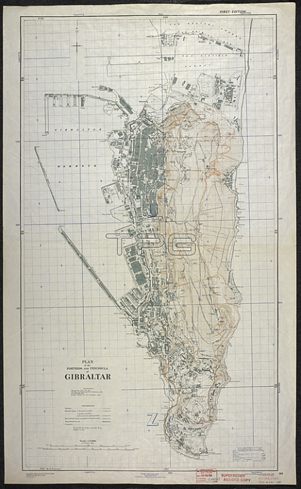
Plan of the fortress and peninsula of Gibraltar; dated 1944. Based on War Dept plan of 12? to 1 mile. col.; Scale 1: 5 280.[S. l.]: [s. n.]; 1944-1956. Great Britain. Department of Works.From: Plan of the fortress and peninsula of Gibraltar; GSGS 4389.Maps. MOD GSGS 4136London; British Library.
| px | px | dpi | = | cm | x | cm | = | MB |
Details
Creative#:
TOP21011688
Source:
達志影像
Authorization Type:
RM
Release Information:
須由TPG 完整授權
Model Release:
No
Property Release:
No
Right to Privacy:
No
Same folder images:
Restriction:
Additional permissions needed for non-editorial use.
 Loading