
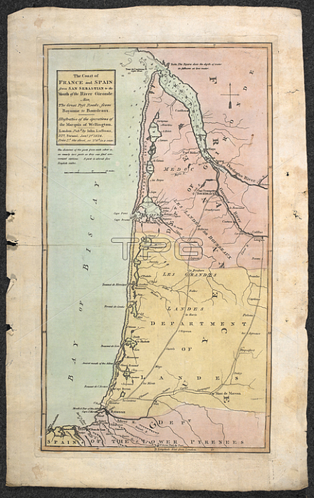
A 19th century map of the coast of France and Spain from San Sebastian to the mouth of the River Gironde. Also; the great post roads from Bayonne to Bordeaux. ; 1 map: hand col ; 40 x 22cm.; Scale [ca. 1: 600 000]. Miles; 52 [= 42mm].London: Published by J. Luffman; 377; Strand; Jan. y 1. st 1814.From: John Luffmann; The coast of France and Spain from San Sebastian to the mouth of the River Gironde. Also; the great post roads from Bayonne to Bordeaux. Illustrative of the operations of the Marquis of Wellington.Maps CC. 5. a. 339.London; British Library.
| px | px | dpi | = | cm | x | cm | = | MB |
Details
Creative#:
TOP21011439
Source:
達志影像
Authorization Type:
RM
Release Information:
須由TPG 完整授權
Model Release:
No
Property Release:
No
Right to Privacy:
No
Same folder images:
Restriction:
Additional permissions needed for non-editorial use.
 Loading