
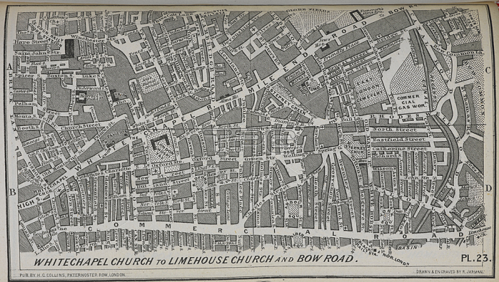
Whitechapel Church to Limehouse Church and Bow Road. Part of the first street atlas of London published in 1854.London; 1854.From: Collins' Illustrated Atlas of London with 7000 references; in 36 plates of the principal routes between St. Paul's and the suburbs; from a survey made expressly for this work; by R. Jarman.Maps 28. bb. 22; plate 23London; British Library.
| px | px | dpi | = | cm | x | cm | = | MB |
Details
Creative#:
TOP21010972
Source:
達志影像
Authorization Type:
RM
Release Information:
須由TPG 完整授權
Model Release:
No
Property Release:
No
Right to Privacy:
No
Same folder images:
Restriction:
Additional permissions needed for non-editorial use.
 Loading